The sextant and the nautical almanac: three centuries of celestial navigation
From the cross-staff to the sextant, from the longitude race to today’s almanacs: how sailors learned to find their position with the sky, and how to read our Sun and Moon ephemerides for 2027–2035.
For three centuries, navigators fixed their position with a brass instrument, a watch and a book of numbers. The sextant measures the altitude of a body above the horizon; the almanac says where that body is at any moment; a little trigonometry does the rest. GPS has made the method unnecessary day to day, but not obsolete: it depends on no satellite and no battery, and it remains one of the finest applications of astronomy.
This article traces the history of the instrument and of the tables, then explains how to read the Sun and Moon ephemerides of our almanac for 2027–2035.
Before the sextant: measuring latitude
Finding your latitude has been easy since antiquity: the altitude of the Pole Star above the horizon roughly equals the latitude of the place, and the altitude of the Sun at noon gives it too, once you know the Sun’s declination for the day. All it takes is measuring an angle.
Portuguese navigators of the late 15th century carried a mariner’s astrolabe for this, a heavy bronze disc hung to sight the Sun, and the quadrant. In the 16th century the cross-staff, or Jacob’s staff, took over. The astronomer Levi ben Gerson had described it in the 14th century: a graduated rod with a sliding transom, sighted by eye between the horizon and the body. You had to look straight at the Sun. In 1594 the English navigator John Davis invented the backstaff, which measures the Sun’s altitude with your back to it, by the shadow of a vane.
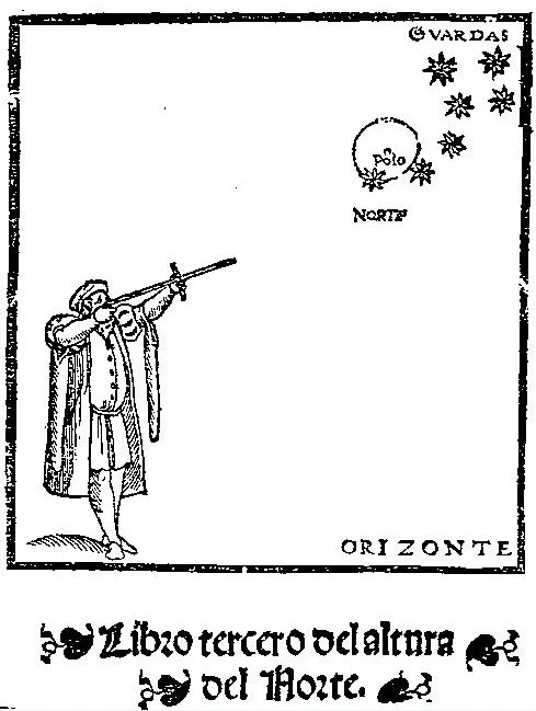
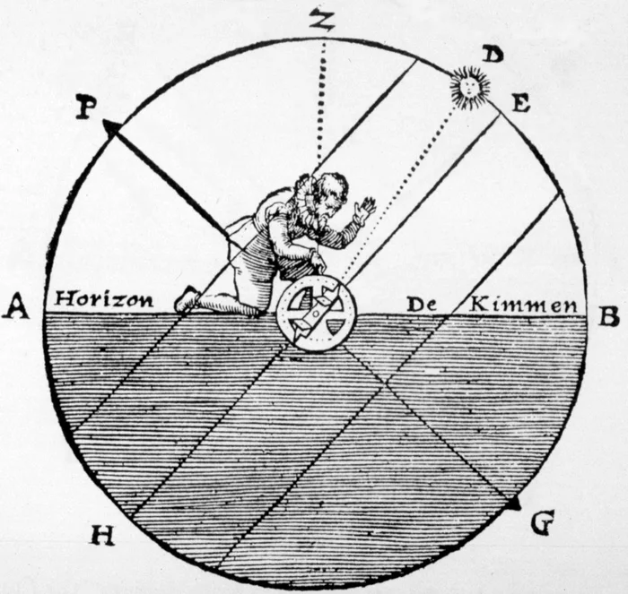
All these measurements are made aboard a rolling ship, sighting two directions at once. Their accuracy seldom beat half a degree, some thirty nautical miles.
Double reflection: the octant, then the sextant
The breakthrough came from optics: with two mirrors, you see the horizon and the body superimposed in the same telescope. The ship may roll; both images move together. Isaac Newton had drawn up the principle, but his paper, entrusted to Edmond Halley, was only found in 1742. Meanwhile, in 1731, John Hadley presented his octant to the Royal Society; the American Thomas Godfrey had designed one independently in Philadelphia.
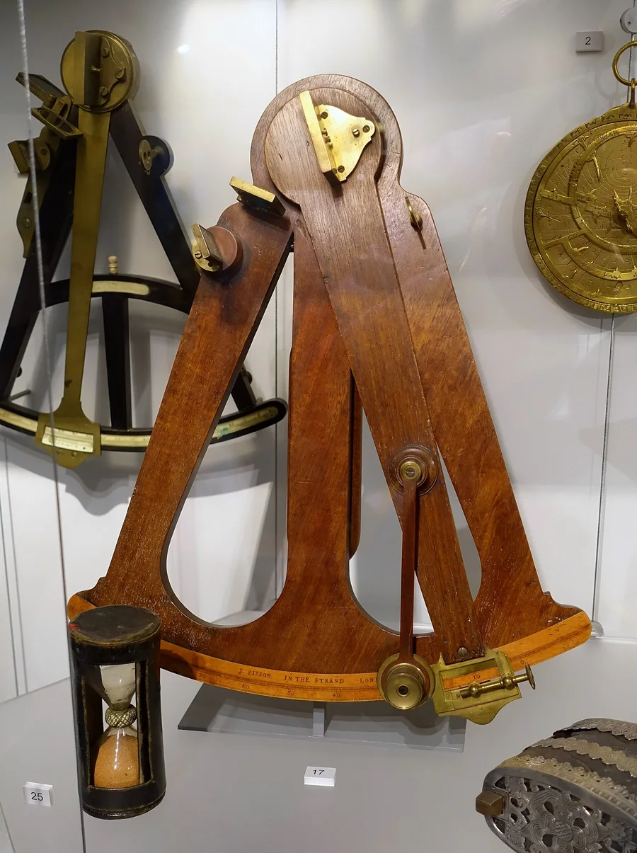
Thanks to double reflection, an arc of one eighth of a circle (45°) measures angles up to 90°. In 1757 Captain John Campbell proposed lengthening the arc to one sixth of a circle (60°) to measure up to 120°. That is the sextant, whose shape has barely changed since. The extra length was no detail: finding longitude meant measuring large angles between the Moon and a star.
At the end of the 18th century, Jesse Ramsden’s dividing engine made it possible to engrave scales accurate to a few seconds of arc. With a vernier, then a micrometer drum, a good sextant reads to a tenth of an arcminute.
The longitude problem
Longitude held out. The Earth turns 15° an hour, so knowing your longitude means knowing the difference between local time, given by the Sun, and the time on a reference meridian at the same moment. Without a reliable clock at sea, that was impossible. Shipwrecks piled up, and in 1714 the British Parliament passed the Longitude Act, promising £20,000 to whoever found a practical method.
Two solutions competed.
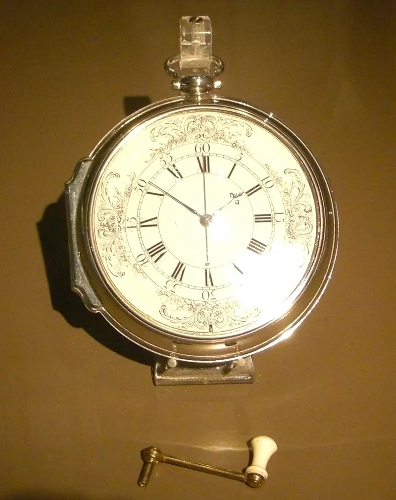
- Marine clocks. The clockmaker John Harrison devoted his life to a clock that would keep time despite rolling seas and changing temperatures. His fourth, H4, a large watch, lost only a few seconds on the voyage to Jamaica in 1761–1762. James Cook carried a copy, K1, on his second voyage (1772–1775) and called it a trusty guide. But chronometers would long stay rare and costly.
- Lunar distances. The Moon moves about its own diameter per hour against the stars: a celestial clock, readable from anywhere. With a sextant you measure its angular distance to a star, and tables give the corresponding Greenwich time. The method needs very accurate Moon tables, which the German astronomer Tobias Mayer provided, and hours of calculation.
In 1766 the Astronomer Royal Nevil Maskelyne published the first Nautical Almanac, for the year 1767, with lunar distances computed every three hours. In France, the Connaissance des temps, founded in 1679 by Abbé Jean Picard, published lunar distances too; it is today the oldest ephemeris published without interruption. The Bureau des longitudes, created in 1795, took it over. Only in the 19th century did chronometers become cheap enough to equip every ship and make lunar distances unnecessary.
The line of position
With a sextant and a chronometer, navigators could measure a body’s altitude and know Greenwich time. What remained was to read that measurement properly. It was used to work out the longitude, assuming the latitude was known: if the latitude was wrong, so was the longitude. On 17 December 1837, approaching the St George’s Channel after days of fog, the American captain Thomas Sumner doubted his latitude. He redid the calculation with three different latitudes: the three positions lay in a line, which ran through the Smalls lighthouse. He followed that line, and the lighthouse came into view. One altitude of the Sun gives not a point but a line you are on, and two lines cross at your position.
In 1875 the French naval officer Adolphe Marcq de Blond de Saint-Hilaire published the intercept method, still taught everywhere. At any moment each body is straight above a point of the Earth, its geographic position. Measuring its altitude tells you that you are on a circle centred on that point. The circle is huge, but near your assumed position it can be replaced by a straight line. Compute the altitude the body would have from the assumed position; the difference with the observed altitude, in arcminutes, gives the distance of the line of position in nautical miles. That is exactly what our celestial fix tool does.
That computation is spherical trigonometry. The celestial pole, the observer’s zenith and the body make a triangle on the celestial sphere, the position triangle. Its sides are 90° minus the latitude, 90° minus the declination and 90° minus the altitude, and its angle at the pole is the local hour angle. Viète’s formula, named after the French mathematician who published it in 1593 (equivalent forms were known before him), links one side to the other two and the angle between them. Applied to this triangle, it gives the computed altitude at once: sin Hc = sin φ · sin δ + cos φ · cos δ · cos LHA. A related formula gives the body’s azimuth, which sets the direction of the line of position. Both are on our formulas card, together with the general Viète formulas: enter every value but one and the card works out the last.
In the 20th century, ready-made sight reduction tables and the Air Almanac made the method fast enough for air navigators, who used bubble sextants. Then GPS relegated it to a backup. In the 2010s, however, several navies, including the US Navy, put it back into their officers’ training: a sextant cannot be jammed.
What an almanac contains
To the navigator, a celestial body is located like a place on Earth:
- its declination is the latitude of its geographic position, positive north;
- its Greenwich hour angle, or GHA, is the longitude of that position, counted westward from 0 to 360°.
The Sun’s GHA grows by about 15° an hour, the Moon’s by about 14°, a little more or less depending on the day. The almanac gives both values at every whole hour of universal time (UTC), with their hourly changes: v, the excess of the GHA change over 15° (Sun) or 14° (Moon), and d, the change in declination, in arcminutes per hour. For a sight taken between two whole hours, start from the value at the previous whole hour and add the change in proportion to the minutes elapsed.
The almanac also gives what is needed to correct the measured altitude: the semi-diameter of the Sun or Moon, since you sight their limb and not their centre, and the Moon’s horizontal parallax, as it is so close that its direction depends on where you see it from.
Our ephemerides
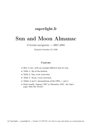
We offer a booklet to print and bind, from 2027 to 2035: for each month, the Sun’s page then the Moon’s.
The booklet opens with instructions and the tables that take you from the sextant reading to the true altitude: the dip of the horizon for your height of eye, the total correction for the Sun and the Moon, which combines refraction, parallax and semi-diameter, the GHA increments for minutes and seconds, and the v and d corrections. They are computed with the same formulas as our celestial fix tool.
The Sun takes two rows per day: the first gives the GHA, the second the declination, for the 12 hours around solar noon in the Mediterranean (set for Marseille). The last column gives v on the GHA row and d on the declination row. The month’s semi-diameter is printed below the table.

The Moon follows the same pattern, over 11 hours centred on its meridian passage. As the Moon crosses the meridian about 50 minutes later each day, the window shifts by one hour a day. To find the column of a sight, take (UTC hour − day number) modulo 24: on the 12th at 10 h UTC, the column headed 22 (10 − 12 = −2, that is 22). Two more columns give the semi-diameter and the horizontal parallax, and a small symbol marks the days of the phases.
The positions were computed with the PyEphem library for the Sun, and with Skyfield and the Jet Propulsion Laboratory’s DE421 ephemeris for the Moon. They are rounded to a tenth of an arcminute, the precision of a sextant reading.
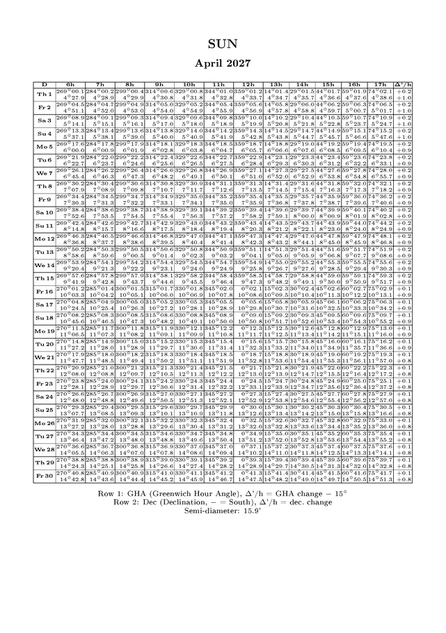
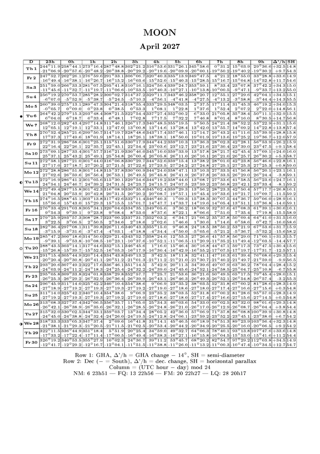
The ephemerides are released under the Creative Commons BY-NC-SA 4.0 licence: print them, share them, take them aboard, as long as you credit the source, make no commercial use of them and release any adaptation under the same licence.
A worked example
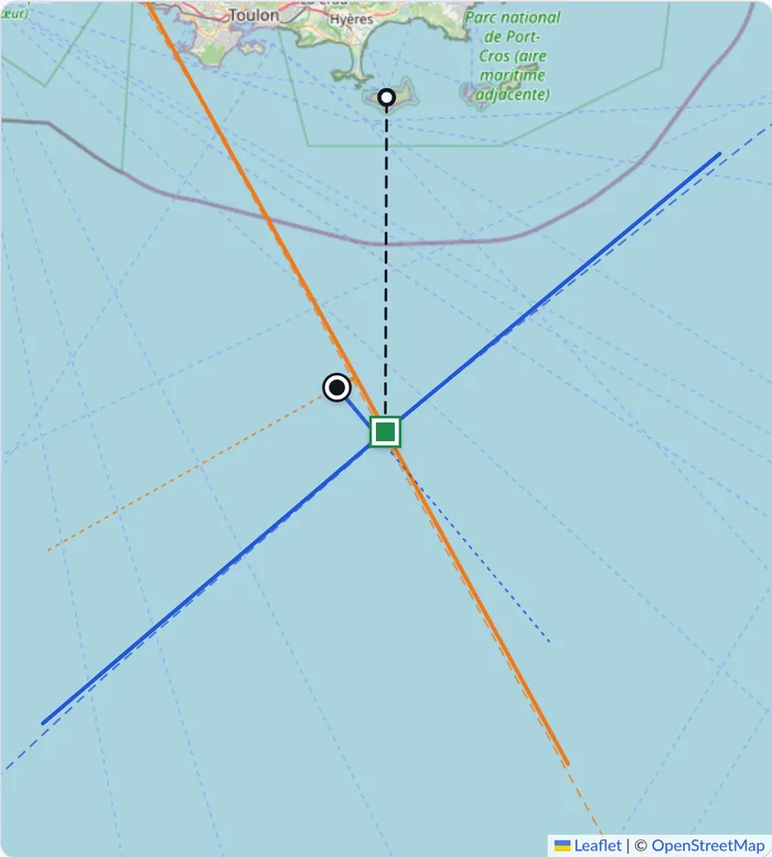
On 11 April 2027, about thirty miles south of Porquerolles, the coast is out of sight. At 14 h 30 min 52 s UTC you measure the altitude of the Sun’s lower limb: the sextant reads 38°35.7′, its index error is +1.4′, and your eye is 2.5 m above the water.
The altitude. 38°35.7′ − 1.4′ = 38°34.3′. The dip (table 1) takes off 2.8′: 38°31.5′. The Sun’s total correction (table 2, April to September) adds 14.8′: the true altitude is 38°46.3′.
The Sun’s position. On the April 2027 page, in the row for the 11th, column 14 h, you read:
| Value at 14 h | Δ′/h | |
|---|---|---|
| GHA | 29°43.7′ | +0.2 |
| Declination | 8°22.1′ | +0.9 |
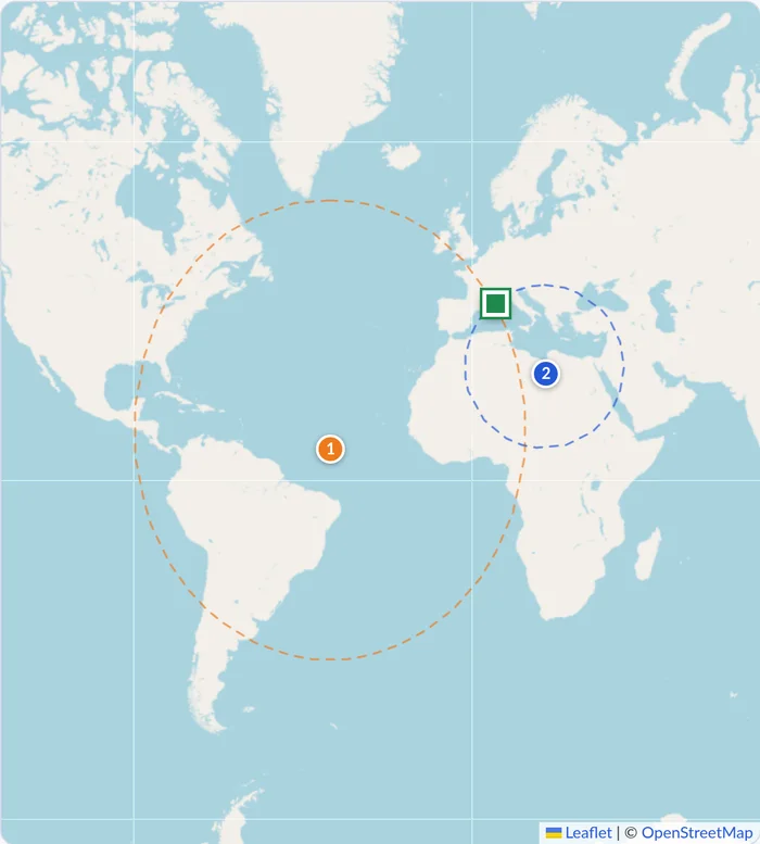
For the 30 min 52 s since, table 4 gives 7°30.0′ + 13.0′ = 7°43.0′, and table 5 adds 0.1′ for v: the GHA is 37°26.8′. Table 5 also gives +0.5′ for d: the declination is 8°22.6′ N. The Sun stands overhead at 8°22.6′ N, 37°26.8′ W, in the middle of the Atlantic.
All that is left is to enter these values and your dead reckoning in the celestial fix tool, which draws the line of position. A second sight, the Moon at 14 h 41 min 33 s, gives the second line: that is the tool’s example, and the figure below.
Getting a fix
A single line of position does not give a fix: you need two, with clearly different azimuths, ideally at right angles. The Sun in the morning and the afternoon, allowing for the distance run in between, or the Sun and the Moon when both are up in daylight, will do.
On land, you can practise with an artificial horizon, a tray of water or oil in which you sight the body’s reflection; the measured angle is then twice the altitude.
Download
Sun and Moon almanac 2027–2035
The Sun and the Moon month by month, with the correction tables
- 3.1 MB
- 223 pages
- CC BY-NC-SA 4.0