A sky atlas to download and print
80 charts at a single scale, 50,000 stars, the deep-sky objects, the Milky Way and the paths of the outer planets: a complete atlas to print.
To find a galaxy with binoculars or point a telescope at a cluster, you need a chart. Not an app that dazzles eyes adapted to the dark, but a real paper chart, laid on the camping table and read under a red light. We built ours from the big public astronomical catalogues, and here it is: 98 pages, 80 charts, and everything you need to find your way under a dark sky.
What is inside
- 80 charts at a single scale, covering the whole sky from pole to pole.
- About 50,000 stars, down to magnitude 8: what binoculars or a finder scope show under a decent sky.
- Double stars, marked with a bar, and variable stars, marked with a ring that shows their brightest and faintest magnitudes.
- Deep-sky objects: the 110 Messier objects, galaxies to magnitude 12, open clusters to 9, globular clusters to 10.5, planetary nebulae to 12, nebulae that have a name or span at least 5′, and a few celebrities outside the catalogues: Markarian’s Chain, the large dark nebulae, the brightest Collinder and Melotte clusters.
- Constellation figures with their names, the ecliptic, and the Milky Way in five brightness levels.
- The paths of the outer planets: Uranus from 2028 to 2032, Neptune from 2028 to 2035, Pluto from 2028 to 2040, and the Voyager 1 and 2 probes from 2028 to 2040, with a dot on every 1 January.
- Three fixed markers: the radiants of the Perseids and the Geminids at their maximum, and the centre of the Galaxy.
You can also browse this data without page edges in the interactive sky atlas: pan, zoom and rotate it freely.
How the atlas is organised
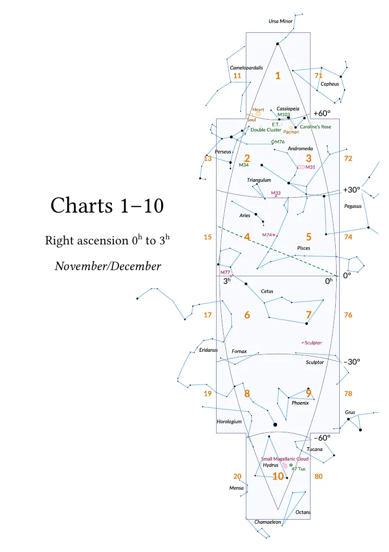
The sky is cut into eight gores of three hours of right ascension, and each gore into ten charts, north to south: a north polar cap, then four bands of two charts (east and west halves) down to the south polar cap. Charts 1 to 10 cover the gore from 0h to 3h, charts 11 to 20 the one from 3h to 6h, and so on to chart 80.
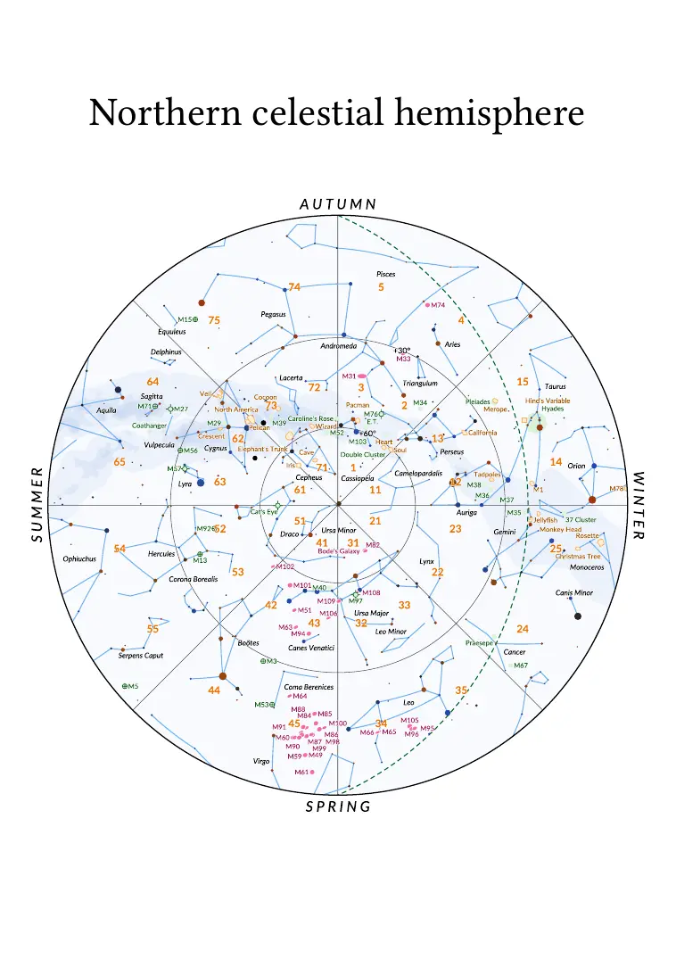
The atlas opens with two hemisphere maps (pages 2 and 3) that give, for every region of the sky, the number of the chart to turn to. Each gore then starts with an overview page, facing its first chart, that shows how its ten charts fit together. The east and west halves of a band face each other: one glance takes in the whole gore.
All charts share the same scale, 14.4 points per degree (about 5 mm), and the same frame. The grid is perfectly regular: no chart is shifted to frame a constellation, so you move from a chart to its neighbour without surprises. The projections keep distortion low: azimuthal equidistant at the poles, conic equidistant elsewhere.
Reading a chart
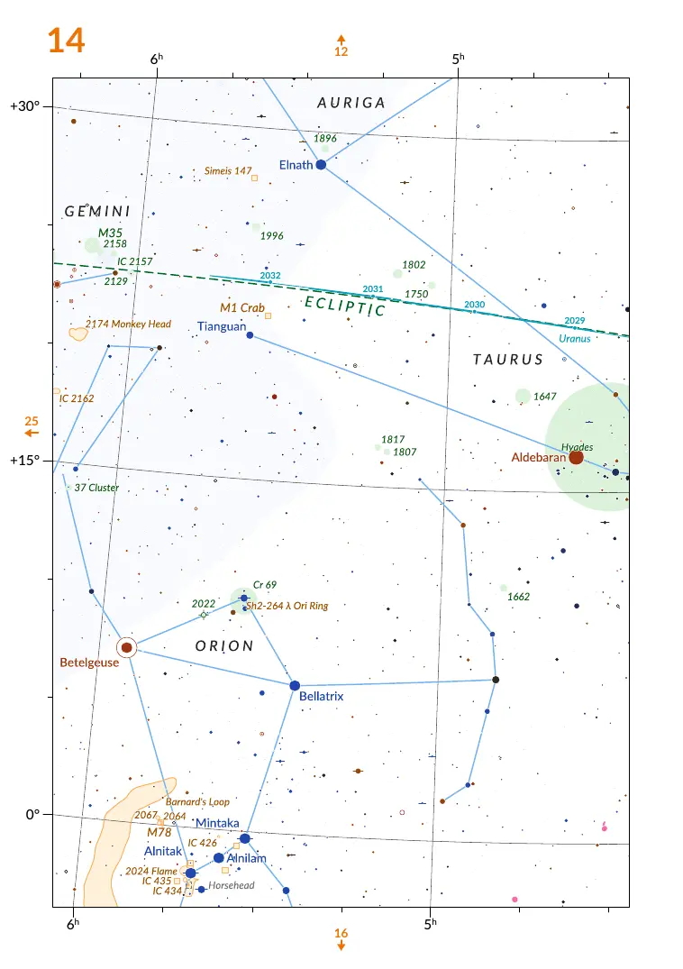
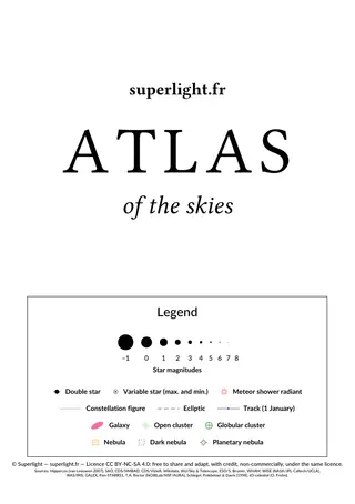
The legend fits on the first page and is repeated at the head of each gore. The size of the dot gives the star’s magnitude, from –1 to 7. A bar through the dot marks a double star (companion of magnitude 9.5 or brighter, 2″ to 60″ away); a ring around the dot, a variable whose brightness changes by at least 0.5 magnitude.
Each kind of deep-sky object has its symbol: a pink ellipse for galaxies, to scale and oriented; a pale green disc with a dotted rim for open clusters, crossed for globular clusters, with four ticks for planetary nebulae; an orange outline for nebulae, drawn from their real shape when it is known; dotted grey for dark nebulae.
Objects carry their Messier number, otherwise their NGC or IC number, followed by the common name when there is one: “M82 Cigar”, “4631 Whale”. Stars of magnitude 3 or brighter carry their official International Astronomical Union name.
Printing and using the atlas
Print it in A5 or in A4: two pages per landscape A4 sheet at 100% for an A5 atlas, or one page per A4 or Letter sheet, fitted to the page, for larger charts. Heavy paper and a spiral binding make a fine field atlas. Against dew, the best is a synthetic paper (polyester, sold as “tear-proof and waterproof”), printed with a laser printer: water leaves no mark on it. Failing that, a 150 g matte coated paper stands up to damp far better than plain paper, which cockles.
The file asks PDF readers to open in two-page view with the cover alone: the east and west halves of each band then face each other as in a book. If your reader ignores it, turn on its “cover page” or “odd pages on the right” option.
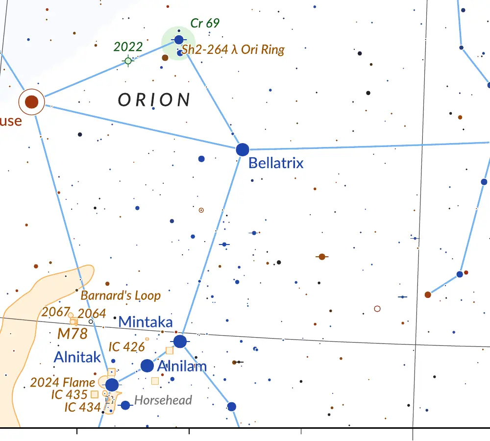
In the field, the simplest is to start from the hemisphere map: find the constellation there, then the number of the detailed chart. A dim red light preserves night vision. With binoculars, a 7° circle drawn on a transparency, 36 mm at the atlas scale, gives roughly the field of a 7×50 pair: lay it on the chart to know what you should see in the eyepiece.
The atlas is released under the Creative Commons BY-NC-SA 4.0 licence: you may print it, share it and adapt it, as long as you credit the source, make no commercial use of it and release your adaptations under the same licence.
Download
Atlas of the Skies
80 charts, 50,000 stars
- 19 MB
- 98 pages
- CC BY-NC-SA 4.0